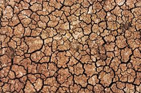
Nasa is publishing data from its first worldwide soil moisture satellite programme on Google Earth, in a bid to boost global food security.
The American space agency’s project, dubbed SMAP, will provide farmers across the world with data on the water content of their soil using tools developed by a team at NASA’s Goddard Space Flight Center in Greenbelt, Maryland.
The data will be incorporated into the Crop Explorer website of the USDA’s Foreign Agricultural Service, which reports on regional droughts, floods and crop forecasts.
John Bolten, research scientist at Goddard said: “There’s a lot of need for understanding, monitoring, and forecasting crops globally. SMAP is Nasa's first satellite mission devoted to soil moisture, and this is a very straightforward approach to applying that data.”
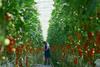
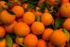
Variations in global agricultural productivity have tremendous economic, social and humanitarian consequences.
Iliana Mladenova, a research scientist at Goddard said: “The USDA does crop forecasting activities from a global scale, and one of the main pieces of information for them is the amount of water in the soil. This allows the agriculture analysts to better predict where there could be too little, or too much, water in the soil to support crops.”
The soil moisture conditions, along with tools to analyze the data, will be made available on Google Earth Engine where researchers, nonprofits, resource managers and others can access the latest data as well as archived information.
“If you have better soil moisture data and information on anomalies, you’ll be able to predict, for example, the occurrence and development of drought,” Mladenova added.
With global coverage every three days, SMAP can provide the Crop Explorer tool with timely updates of the soil moisture conditions that are essential for assessments and forecasts of global crop productivity.